TecAfrica Solutions
DJI Mavic 3M Multispectral Drone
DJI Mavic 3M Multispectral Drone
Couldn't load pickup availability
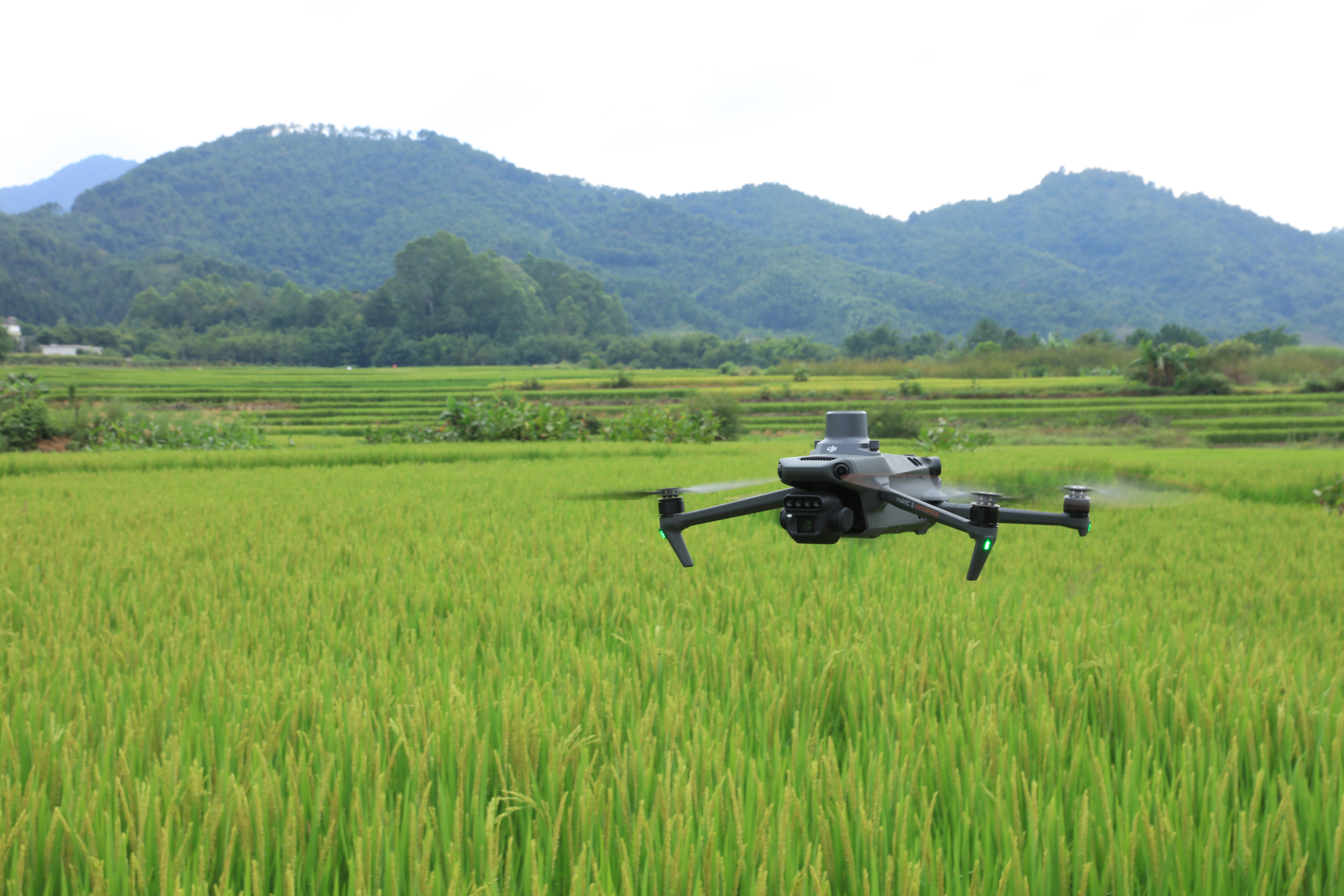
The Mavic 3M Multispectral Drone. First of all, this impressive drone has effective aerial surveying that can all but see the invisible. “How?” you ask. Well, the Mavic 3 Multispectral has two forms of sight. Because It combines an RGB camera with a multispectral camera it is able to scan and analyze crop growth with total clarity. This allows agricultural production management to work smoothly as this drone provides not only precision but extensive data as well.
The Impressive Mavic 3M Multispectral Drone
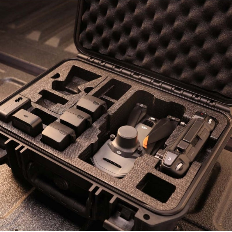
Whereas if you are looking for an all-inclusive system to survey your land, this is the perfect tool. The Mavic 3M Multispectral Drone has a compact and portable design that can be folded up when not in use making it easy enough
to store anywhere without taking up too much space or compromising functionality! In addition to all that, it also comes equipped with powerful sensors such as multispectral (4 x 5MP), and RGB cameras at 20 MP resolution combined together into one integrated imaging system which provides both environmental data from bands like G/R+RE
- Compact and portable
- Foldable for easy storage
- Multispectral Camera
- 4 × 5MP
- G/R/RE/NIR
- RGB camera
- 20 MP
- 4/3 CMOS, mechanical shutter
- Safe and stable
- Omnidirectional Obstacle Avoidance [1]
- 15km Transmission Distance [2]
- Precise positioning
- Centimetre-level RTK positioning
- Microsecond-level time synchronization
- Efficient aerial surveying
- Up to 200 hectares per flight [3]
- Multispectral + RGB imaging system
- A highly integrated imaging system
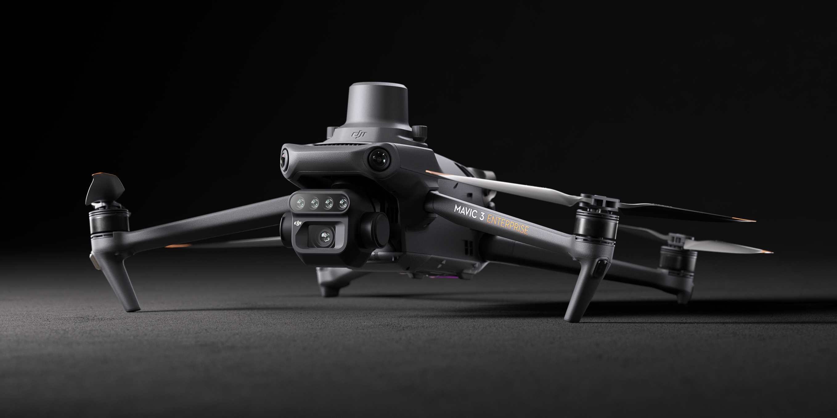
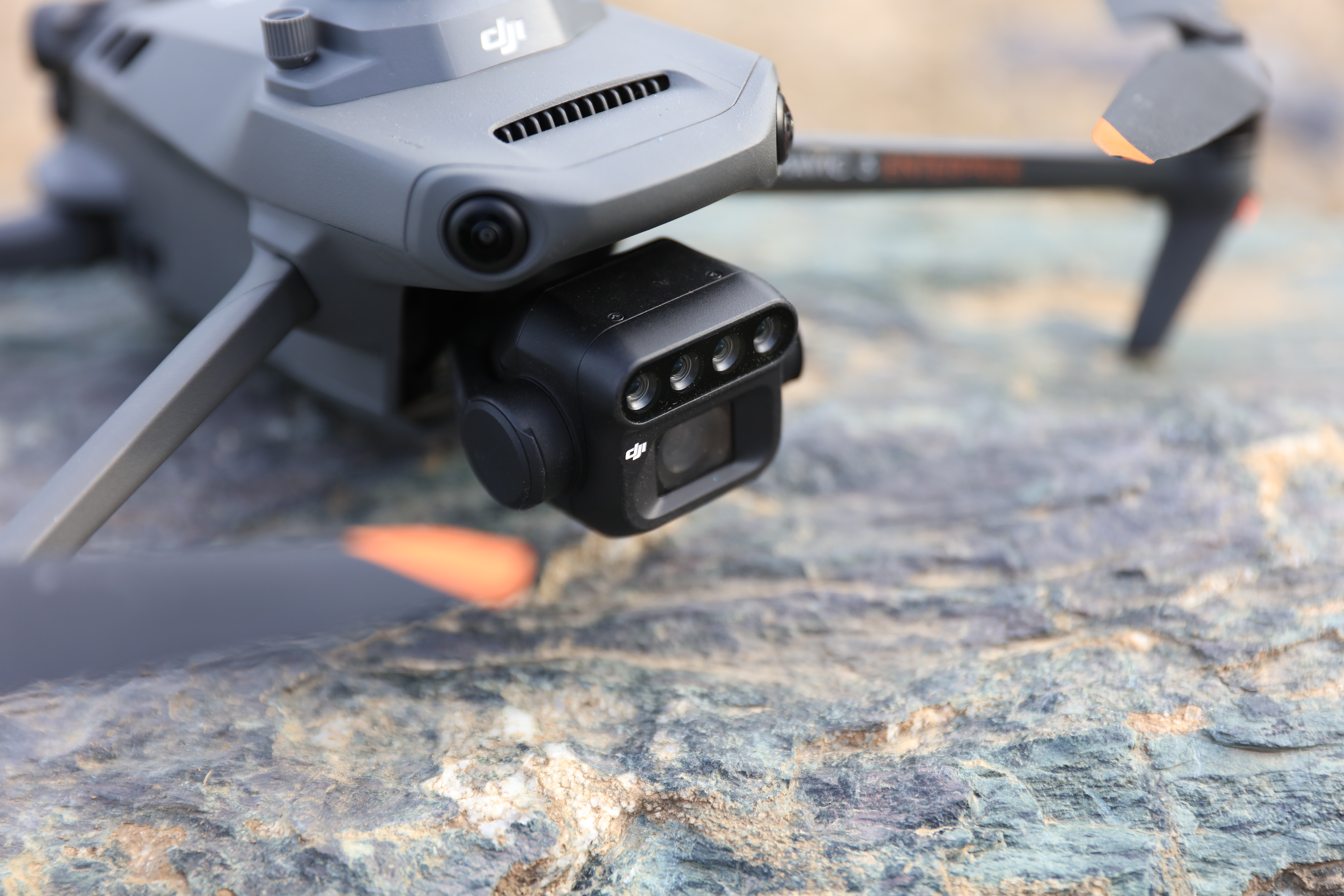
Mavic 3M Multispectral Drone Newly Upgraded Imaging System
Newly upgraded imaging system with one 20MP RGB camera and four 5MP multispectral cameras (green, red, red edge, and near-infrared). Enables applications such as high-precision aerial surveying, crop growth monitoring, and natural resource surveys. The DJI Mavic 3 Pro has an impressive collection of features, from its high-speed shutter speed to sunlight detection. The aircraft itself is also extremely light at only 1 pound per unit volume and 23% less than competitive products like the Zinitevi Falcon 2 or Phantom 4 Series Rice Digital Domain.
- 5 MP Multispectral Camera
- Near-infrared (NIR)
- 860 nm ± 26 nm
- Red edge (RE)
- 730 nm ± 16 nm
- Red (R)
- 650 nm ± 16 nm
- Green (G)
- 560 nm ± 16 nm
- RGB camera characteristics
- 4/3 CMOS
- 20MP image sensor
- 1/2000s
- Fastest mechanical shutter speed
- 0.7s
- High-speed burst when RGB camera is used
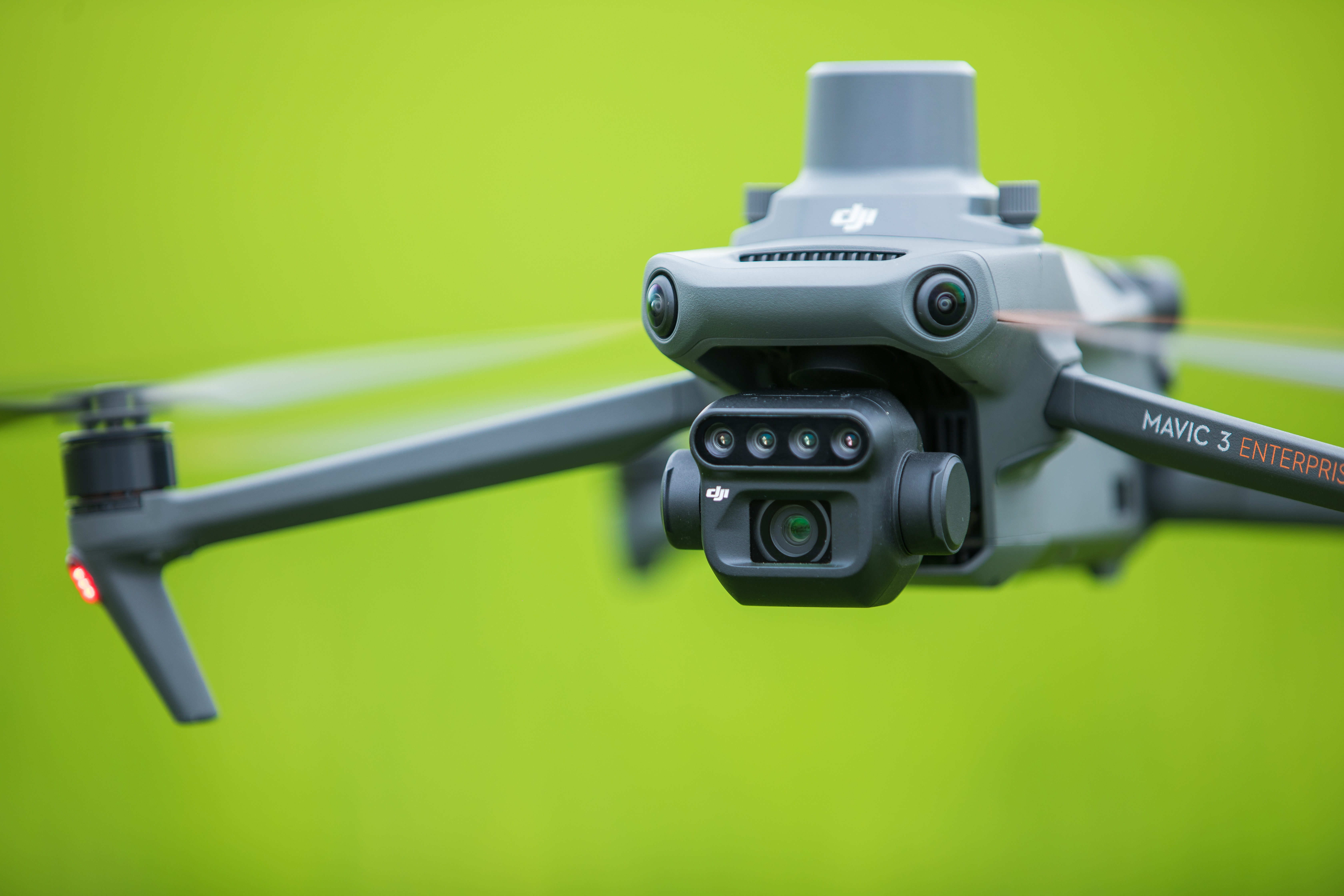
- Sunlight Sensor
Because the Mavic 3M Multispectral Drone has a built-in sunlight sensor that captures solar irradiance and records it in an image file, it allows for light compensation of image data during 2D reconstruction. This results in more accurate NDVI results, as well as improved accuracy and consistency of data acquired over time.
Incredibly Accurate Images That Capture Every Pixel
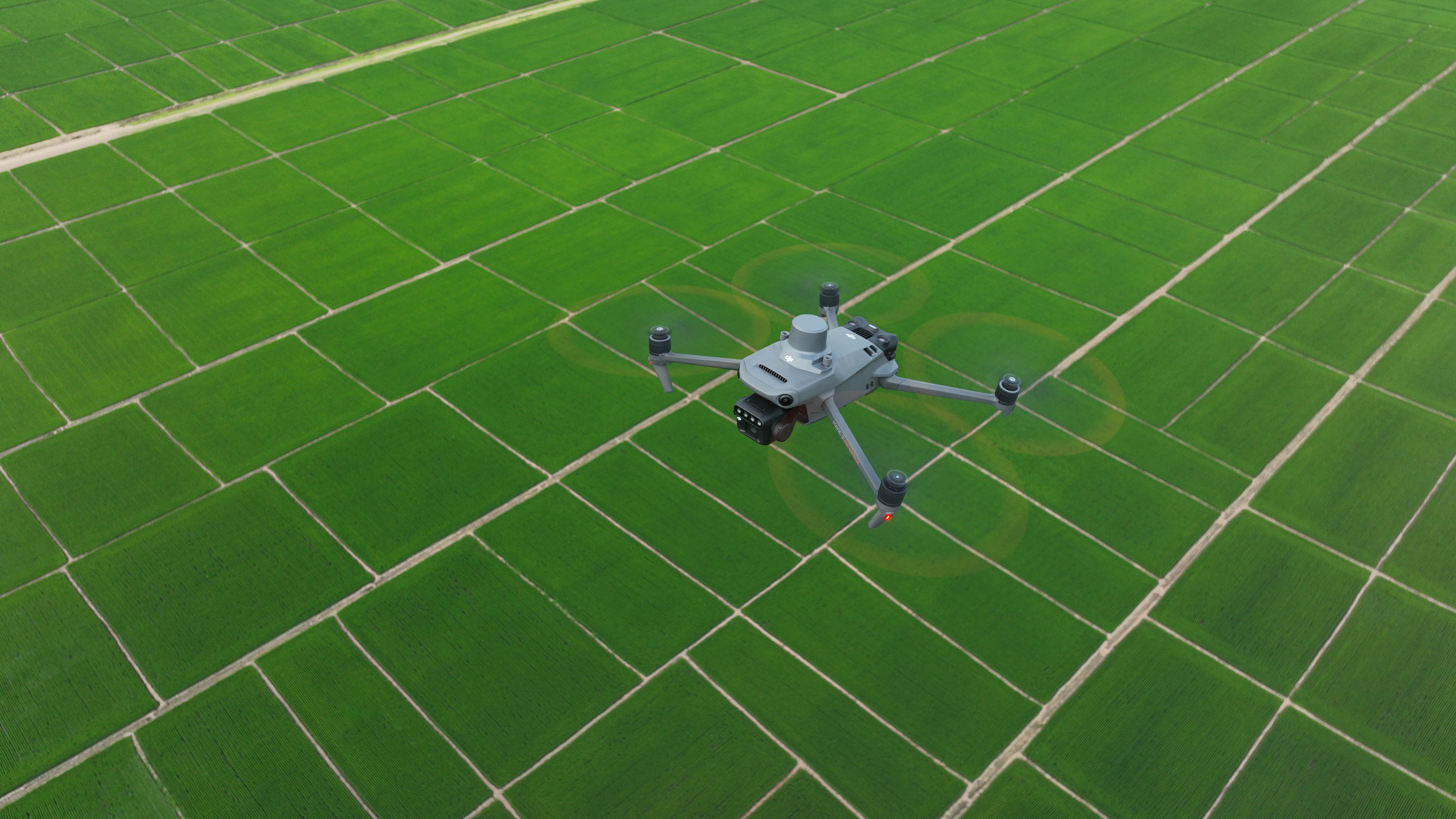
Mavic 3M with RTK module for centimetre-level positioning. Flight control, the camera, and the RTK module sync in microseconds to accurately capture the location of each camera’s imaging centre. This enables Mavic 3M to do high-precision aerial surveying without using ground control points.
Highly Efficient and Reliable Battery Life with Fast Bursts
The Mavic 3M Multispectral Drone has a cruising time of 43 minutes and can complete mapping operations over an area measuring 200 hectares. With the Mavic 3M Multispectral Drone, you can capture images of your surroundings in unparalleled detail. This device has three different sensor settings that allow for optimal information about light sources and objects within its field of view to be recorded by one single battery charge – no need to concern yourself with flight time! With 100W power output available at each hub on board this drone while charging 88 watts efficiently through fast-charging technology alone will give users nearly two full hours worth of enjoyment before they must return home for more juice; ensuring plenty enough footage is captured during all sortsa adventures without worrying about this drone dying on you mid flight.
Undeniably Stable signal, smooth image transmission
The O3 transmission integrates two transmitting signals and four receiving signals to support 15km ultra-long transmission distances.
Omnidirectional obstacle sensing terrain-follow aerial surveying
The aircraft features multiple wide-FOV vision sensors that accurately detect obstacles in all directions for omnidirectional obstacle avoidance. The terrain-follow aerial surveying can be easily performed in steep-slope landscapes.
The Many Applications of This Drone
Intelligent Orchard Mapping
Mavic 3M allows terrain-follow aerial surveying of orchards, even on sloped landscapes. Together with DJI Terra or DJI SmartFarm Platform reconstruct high-resolution orchard maps, automatically identify the number of trees, distinguish trees from other obstacles or objects, and generate three-dimensional operation routes for agricultural drones, making operations safer and more efficient.
- Mavic 3M aerial surveying
- Mavic 3M aerial surveying
- DJI Terra / DJI SmartFarm Platform Mapping
- DJI Terra / DJI SmartFarm Platform Mapping
- Generate 3D Routes
- Generate 3D Routes
- Agricultural Drone Operation
- Agricultural Drone Operation
- Guide variable rate applications
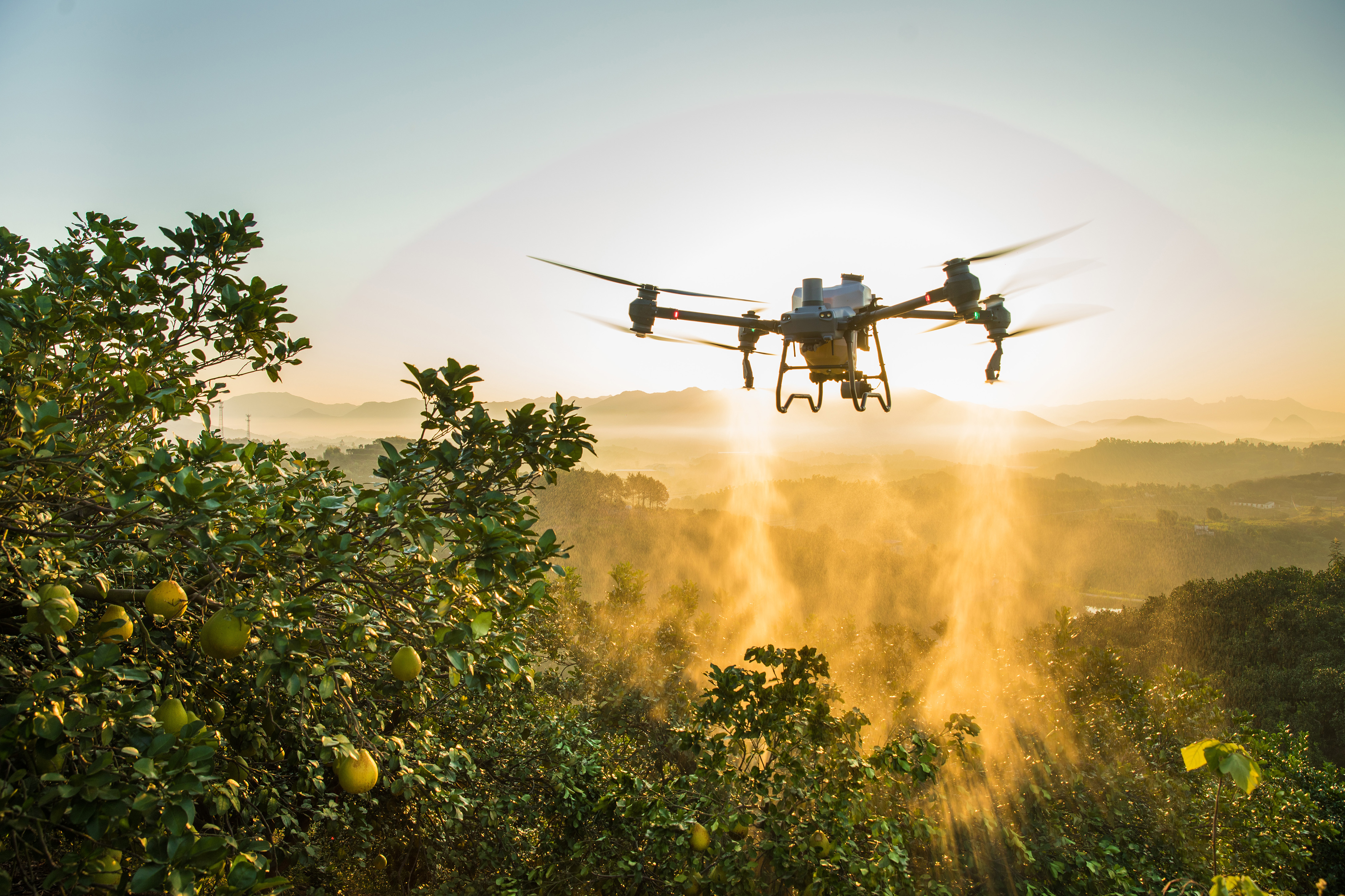
It is hard to find one drone that works for rice fertilization, cotton growth regulation, and potato foliar fertilizer spraying. Yet this drone does it all! The Mavic 3M is used to obtain multi-spectral images of crops. In brief, the DJI Terra or the DJI SmartFarm Platform can then generate NDVI and other vegetation indices maps, capturing differences in crop potential and generating prescription maps that allow agricultural drones to execute the variable-rate application. This ultimately allows users to reduce costs, increase yield, and protect the environment.
- Mavic 3M aerial surveying
- Mavic 3M aerial surveying
- DJI SmartFarm Platform
- DJI SmartFarm Platform
- Generates prescription maps for cropland
- Generates prescription maps for cropland
- Agricultural Drone
- Agricultural Drone
Intelligent field scouting
The Mavic 3M can carry out automatic field scouting. Furthermore, the field scout images can be uploaded to the DJI SmartFarm Platform in real-time through a 4G network. But that’s not all! It can also find abnormalities, such as emergence deficiencies, weed pressure, and crop lodging in a timely manner. Equally as impressive, It can also conduct intelligent analyses, such as cotton seedling identification and rice production testing, using AI identification for real-time sharing of crop growth information, the guidance of agronomic activities, in addition to easy management of 70 hectares of farmland by one person.
Precise Environmental Monitoring and Natural Resources Survey
What’s next? Well, the Mavic 3M can also be used in environment and natural resource surveys, such as water enrichment monitoring, forest distribution surveys, urban green area surveys, and more.
- Water enrichment monitoring
- Forest distribution surveys
- Urban green area surveys
Convenient Open Ecosystem
Cloud API
Because the Mavic 3M can be directly connected to a third-party cloud platform via Pilot 2’s built-in DJI Cloud API based on the MQTT protocol. There is no need to develop an app separately to enable the transmission of UAV equipment information, live streaming, photo data, and other information. Isn’t That amazing?
MSDK
Last but not least, the Mavic 3M is equipped with an advanced multispectral camera that captures increased ranges of visible and near-infrared light, while being able to fly further than any other drone on market. In addition to its durability due to the use of high-grade aluminium alloy which makes up most components such as the flight controller or body shell; this UAV also has full support for Mobile Smart Device sampling allowing developers without programming experience to produce apps tailored specifically for each industry’s needs to through open source production code.
In brief, the Mavic 3M supports Mobile SDK 5 (MSDK5) with a fully open-source production code sample. The MSDK5 makes it possible to develop not only a proprietary control app for UAV field patrol, but also smart surveying, and other scenarios, making it more user-friendly.